

The Possible Source of Multiple Mystery Eruptions; The United States
From GeologyHub · · 5 min
The player loads from YouTube only when you click. It uses YouTube's privacy-enhanced mode.
If the video does not play, the owner may have turned off embedding. Watch it on YouTube instead.
Description
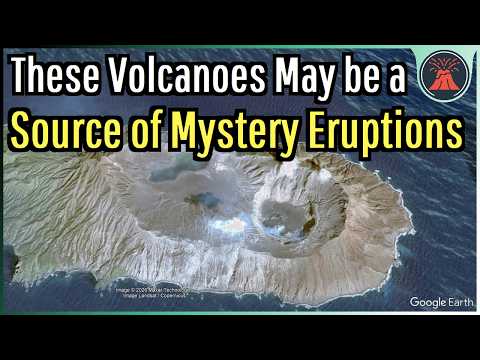
The United States may be the source of multiple very large explosive volcanic eruptions whose sources have remained yet unidentified. That is because a chunk of the nation's volcanoes are understudied, yet contain an abundance of large calderas. What I am referring to are the Northern Mariana Islands, whose calderas will be discussed in today's video.
Thumbnail Photo Credit: Google Earth, Image © 2026 Maxar Technologies, Image Landsat / Copernicus. This image was overlaid with text, and then overlaid with GeologyHub made graphics (the image border & the GeologyHub logo).
If you would like to support this channel, consider using one of the following links: (Patreon: http://patreon.com/geologyhub) (YouTube membership: https://www.youtube.com/channel/UCYeGh5VML5XPr5jYnzh3J6g/join) (Gemstone & Mineral Etsy store: http://prospectingarizona.etsy.com) (GeologyHub Merch Etsy store: http://geologyhub.etsy.com)
Google Earth imagery used in this video: ©Google & Data Providers
This video is protected under "fair use". If you see an image and/or video which is your own in this video, and/or think my discussion of a scientific paper (and/or discussion/mentioning of the data/information within a scientific paper) does not fall under the fair use doctrine, and wish for it to be censored or removed, contact me by email at geologyhubyt@gmail.com and I will make the necessary changes.
Various licenses used in sections of this video (not the entire video, this video as a whole does not completely fall under one of these licenses) and/or in this video's thumbnail image (and this list does not include every license used in this video and/or thumbnail image): Public Domain: https://creativecommons.org/publicdomain/mark/1.0/ CC BY 4.0: https://creativecommons.org/licenses/by/4.0/legalcode CC BY-SA 4.0: https://creativecommons.org/licenses/by-sa/4.0/legalcode
Sources/Citations: [1] U.S. Geological Survey [2] Trusdell, F., Moore, R.B., and Sako, M.K., 2006, Preliminary Geologic Map of Mount Pagan Volcano, Pagan Island, Commonwealth of the Northern Mariana Islands (Version 1.0): U.S. Geological Survey Open-File Report 2006-1386, 32 p.; map, 38.5 by 24 inches, https://doi.org/10.3133/ofr20061386. This source was used to trace Pagan Island's north caldera. [3] van Dijk, E., Jungclaus, J., Lorenz, S., Timmreck, C., and Krüger, K.: Was there a volcanic-induced long-lasting cooling over the Northern Hemisphere in the mid-6th–7th century?, Clim. Past, 18, 1601–1623, https://doi.org/10.5194/cp-18-1601-2022, 2022., CC BY 4.0. [4] W. Hutchison, P. Sugden, A. Burke, P. Abbott, V.V.Ponomareva, O. Dirksen, M.V. Portnyagin, B.MacInnes, J. Bourgeois, B. Fitzhugh, M. Verkerk, T.J. Aubry, S.L. Engwell, A. Svensson, N.J.Chellman, J.R. McConnell, S. Davies, M. Sigl, G.Plunkett, The 1831 CE mystery eruption identified as Zavaritskii caldera, Simushir Island (Kurils), Proc. Natl. Acad. Sci. U.S.A. 122 (1) e2416699122, https://doi.org/10.1073/pnas.2416699122 (2025). CC BY 4.0. [5] Wikipedia, "List of famines", https://en.wikipedia.org/wiki/List_of_famines, CC BY-SA 4.0 license [6] Wikipedia, "Tenpō famine", https://en.wikipedia.org/wiki/Tenp%C5%8D_famine, CC BY-SA 4.0 license [7] NOAA [8] VEIs, dates/years, composition, tephra layer name, DRE estimates, and bulk tephra volume estimates for volcanic eruptions shown in this video which were assigned a VEI 4 or larger (and are not the 1831 eruption of the Zavaritsky Caldera or size estimates of undated caldera forming Northern Mariana Island volcano eruptions) are sourced from the LaMEVE database (British Geological Survey © UKRI), https://www2.bgs.ac.uk/vogripa/view/controller.cfc?method=lameve, Used with Permission. Any time such figures are mentioned in today's video, except for Zavaritsky Caldera's 1831 eruption, they originate from this source. [9] Source of Volcanic Explosivity Index (VEI) methodology and criteria: Newhall, C. G., and Self, S. (1982), The volcanic explosivity index (VEI) an estimate of explosive…